NC/TN 30.8 Mile AT Section Hike
- Jerry Caldwell

- Apr 11, 2021
- 3 min read
Updated: May 30, 2021
Appalachian Trail Section Hike - 30.8 miles
9 April to 11 April, 2021
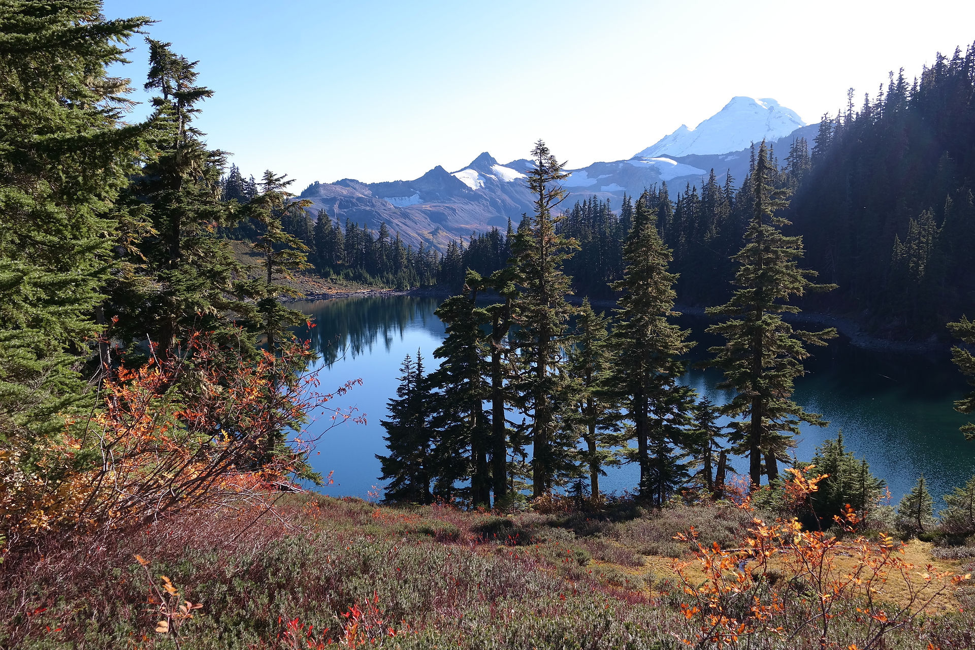
North Carolina & Tennessee: Iron Mtn Gap to Hwy 19E
NoBo. Solo. Continue reading, or watch on it on YouTube.

This hike has some semi-challenging climbs, and takes you over the Roan Highlands.
I parked at Mountain Harbor Hostel, which is located just ¼ mile off the trail on Hwy 19E. I hired a shuttle to Iron Mtn Gap, starting northbound from there around 10:45 AM, Friday April 9th.
Due to the weather forecast I nearly canceled this hike, but using mountain-forecast.com, I noticed the weather for Saturday had improved to rain and wind (understatement), instead of severe thunderstorms.
My goal Friday was 7.1 miles to Little Rock Knob Vista. I arrived there around 2:30 PM. I noticed clouds moving in. There was a chance for rain that evening, and the campsite was exposed. Considering the forecast for Saturday, I decided to push on. I hiked another 5.5 to Ash Gap, putting my day total at 12.6 miles. On the way to Ash Gap I encountered a small thunderstorm which produced hail and wind. My decision to move on was a good one.

The longer-than-expected hike on Friday was a good call. It gave me flexibility on Saturday, lessening my need to knock out a big day in order to get to my car at a reasonable time on Sunday. It turns out I would need this flexibility.

As I descended from Roan High Knob into Carver’s Gap on Saturday, the weather began to worsen, exactly as forecast. Beginning my ascent toward Round Bald, the winds started to pick up. It wasn’t raining yet, but it was foggy so there was no way for me to tell when the rain might hit. I pressed on.


As I began the ascent up Jane Bald, the winds were so strong I was nearly knocked over twice, having to use my hiking sticks to remain upright.
Speaking with other hikers that day, mostly thru-hikers, we had collectively decided the campsite just on the other side of Little Hump Mtn was a good target. About five of us were pushing to get there before the rains hit. We didn't quite make it in time.

As I crested Grassy Ridge it began as a mist. A driving mist, which turned to driving rain within minutes. I arrived at the campsite just before 2 PM, about 11.2 miles for the day, and the rainstorm had begun in earnest. I was able to pitch my rainfly, and then erect my main body tent beneath it. Though I did not keep all of the water out, my tent was mostly dry once I had everything inside and spread out.

I never did put my rain pants on while hiking, and I should have. Not a major mistake as I packed an extra set of hiking pants, and I had dry thermals to sleep in for the evening. And the rain pants came in handy as I had various things to do throughout the evening, including hanging my food bag, while the rain continued relentlessly.
Sunday dawned to chirping birds, a nice breeze, with a low temp of around 39 degrees. It was a pleasant final 7 miles to my car, with some amazing views along the way. It almost made up for the views I missed on Saturday. I arrived at my car by 11:15 AM.

This was my longest solo hike, and my third. I hope to do this section again with some friends, and perhaps during better weather. My finishing day was also my birthday; exactly where I wanted to be as I turned 54.
My pack weight started at 33 pounds, which I was fine with; I carried extra gear due to the weather forecast. For summer hiking, my pack weight should be down to 30 pounds for a 3-night excursion. I am now at 360.1 miles total as a section hiker on the AT.
Despite the weather, I really enjoyed this hike. There was instant camaraderie with fellow hikers battling the elements, and the trail overall is very well maintained and scenic. There are many available campsites for catching a sunrise or sunset. Roan Highlands has a well-deserved reputation.


Comments