Standing Indian Loop 20 Nov
- Jerry Caldwell

- Nov 23, 2020
- 4 min read
Updated: Nov 25, 2020
Standing Indian Loop Hike - 21.9 miles
20 November to 22 November, 2020
Standing Indian Campground near Franklin, NC
Three hikers. Me, Teryl, and Ashley

This was a fun hike with great weather conditions. I now understand why it’s popular. If done clockwise, as we chose, it is mostly gentle climbing or descending terrain, with plenty of views from large peaks, and an abundance of available campsites.
The majority of this hike is along the Appalachian Trail (AT), with entry and exit trails to or from Standing Indian Campground.
There are two primary options for this trail, covered in more detail below.
One night camping on the trail with two days of 10 or miles hiking. This is the option we chose.
Two nights camping with three days of hiking.
Standing Indian Backcountry Information Station.
Instead of entering Standing Indian Campground, veer left at the Y-Intersection and you will come to the Backcountry Information Center. This is a great area to park, and serves as a natural point to begin the loop hike.
We arrived after sunset on Friday evening and pitched our tents under headlamps, right in front of our car. We awoke Saturday morning to 29 degrees. A little on the cold side.

Across the street from the parking area is the Long Branch Trail. This is where we began our adventure just before 8:00 AM. It is a gentle rising trail, taking you to the AT at Glassmine Gap. By this point the temperature was rising nicely under clear blue skies and calm conditions.
From this intersection it was about 3.3 miles to Albert Mountain, where the famous Fire Tower is located. It is a gentle grade most of the way to the top, with a little bit of effort required at the very end. This was the toughest climb of the entire hike.
Back in June of this year I hiked a section from Deep Gap to Winding Stair Gap, which makes for a much tougher direction to ascend Albert Mountain. You can read that trip report here.

After several pictures we pressed on another 1.5 miles for lunch. Our day was gorgeous. By this point we were basically hiking in summer clothes.
Our campsite destination was Carter Gap Shelter. A total of 11.25 miles from the start, we made it there just before 3:00 PM. Ashley and Teryl had decided to use the shelter, leaving their tent in the car. As always, I pitched my tent.
There are more than enough available campsites around and near Carter Gap Shelter. Several groups arrived after us and it never felt crowded. We enjoyed a relaxing afternoon, with some hot tea as the evening temperatures began to drop.


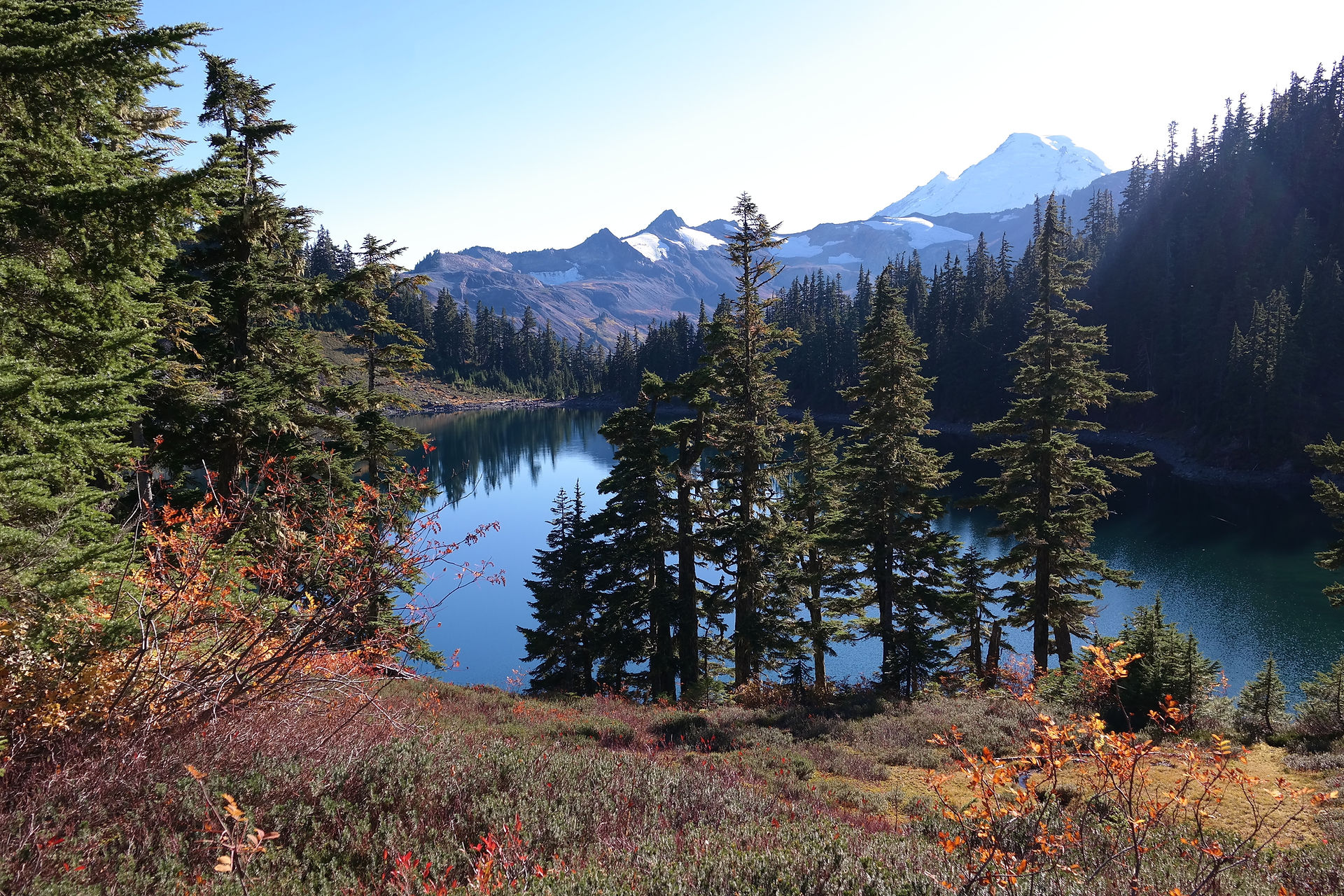
Our weather on Sunday was not as pleasant. We hiked under cloudy skies with a bit of a chilly breeze. The trek to Standing Indian Mountain, just over 6 miles from the campsite, was mostly uphill, but again, nothing strenuous. Arriving at Standing Indian we found ourselves inside a cloud bank and missed the views.
At Standing Indian Mountain is the intersection of the AT and the Lower Trail Ridge. This trail descends down into Standing Indian Campground, which took us back to the parking area at The Backcountry Information Station.
The descent via the Lower Ridge Trail is steep. This was my least favorite part of the hike. I’m simply not a fan of steep descents.

The Lower Trail Ridge was just a bit confusing navigating through the camping area, but worth the effort to remain on it. Otherwise you will have to road-hike around to the parking area. Our last day was a total of 10.65 miles.
This was my third hike with Teryl and Ashley, and as pleasant as the first two hikes. At times we hike as a group, and other times we’ll go our own pace with an agreed rendezvous point.
We spent Saturday afternoon drinking warm beverages, playing cards, and trading snacks. An overall great time.
On the way home Sunday we detoured into Franklin to have a beer and some food at the Lazy Hiker. Great beer selection. Highly recommended.
I look forward to many more hikes with these two.

If I do this hike again I will likely turn it into two nights on the trail, extending it to near 24 miles.
Depart early afternoon on day one. Consider staying at Long Branch Shelter, which would only be 2.55 miles from parking.
Day two, hike 11.9 miles to Beech Gap, which has a water source.
Day three, hike 9.5 miles total, ascending Standing Indian Mountain and then bypassing the Lower Ridge Trail. If you continue down to Deep Gap, you can find Kimsey Creek Trail, which provides a much gentler descent into Standing Indian Campground.
There are other campsites to consider for this loop, allowing you to choose your distance for each day of hiking. This hike can be done counterclockwise for a more challenging adventure.
For more information, here is a great resource: https://www.hikingproject.com/trail/7061919/standing-indian-nantahala-headwaters-loop
About The Author
My name is Jerry. Trail name is Monsoon. In addition to running a hiking club, I also own and operate a coffee shop & bookstore. Check it out here.


Comments